Bureau of Land Management Fortification Geotechnical Investigation
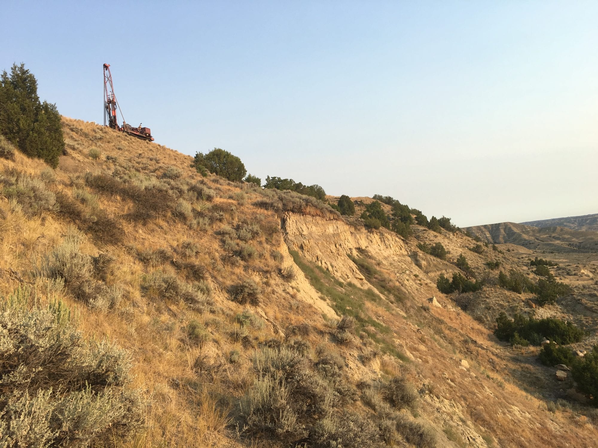
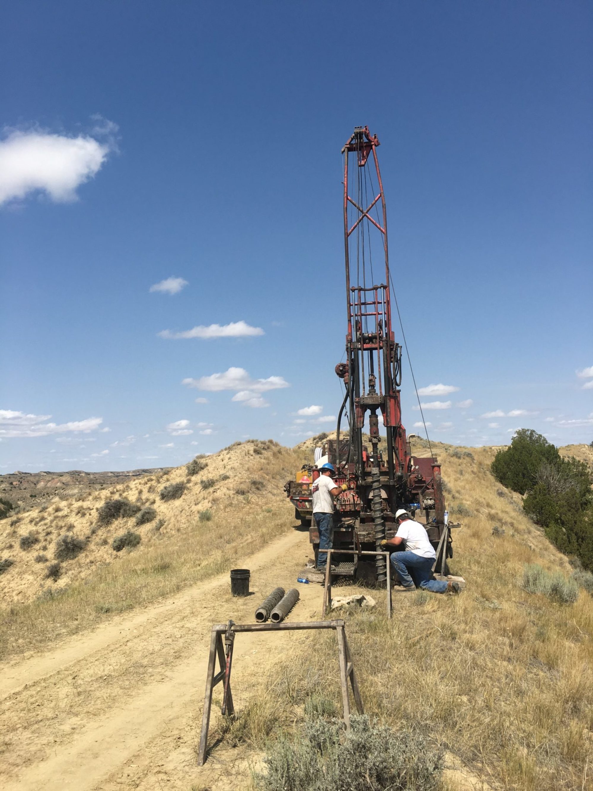
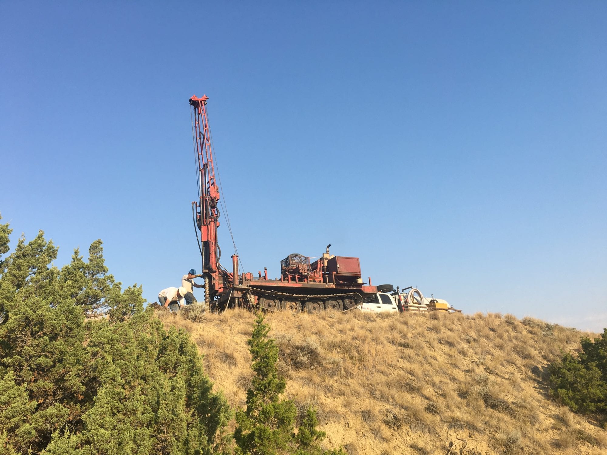
DOWL conducted a geotechnical investigation for the Fortification Geotechnical Investigation Study located west of Gillette, Wyoming. The study consisted of examining an existing landslide that poses potential risks to the boundary road. This included examining stability of the hillside and addressing mitigation and future use. Investigation consisted of a geologic hazard survey, soil borings using a track-mounted drill rig, geophysical seismic velocity surveys, and aerial drone topographic survey.
This project demonstrated our ability to collect data even in the most challenging conditions. The site was only accessible along the slope crest via a two-track dirt road. For this reason, we used a track-mounted rig to access the crest. Because it was a failed slope, it was not possible to access the slope toe with equipment, so geophysical velocity surveys were conducted along the slope crest, at the slope mid-point, and at the slope toe. This allowed for development of a detailed slope cross section. A detailed topographic survey was necessary, but not possible using conventional methods, so an aerial drone survey was completed. This allowed for a detailed topographic survey and collection of aerial photography.
Investigation consisted of a geologic hazard survey, soil borings using a track-mounted drill rig, geophysical seismic velocity surveys, and aerial drone topographic survey.
Location
Campbell County, Wyoming
Region
Mountain West
Client
Bureau of Land Management
Market
Transportation
Services
Geosciences